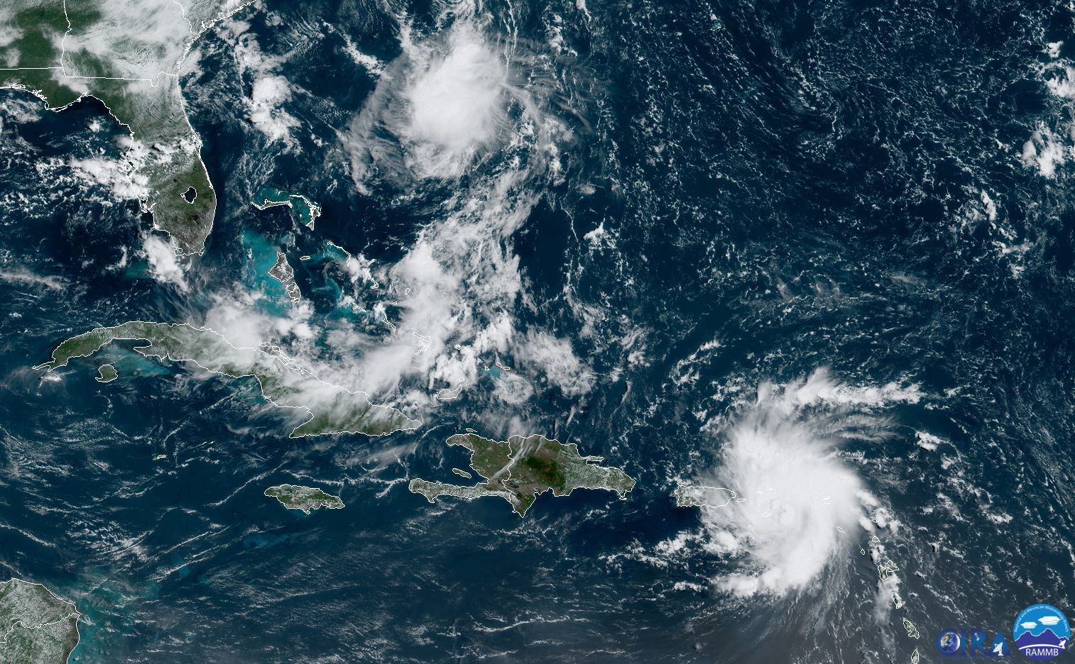
Tropical Storm Dorian appears to pose an increasing threat to the Southeastern United States, potentially including significant landmarks such as Disney World and the Kennedy Space Center.
As of Wednesday morning, Dorian was nearing hurricane strength, with sustained winds of 70mph. The storm's center should pass just to the east of Puerto Rico today and then have as much as four days to strengthen over open ocean before approaching the Florida coast.
The National Hurricane Center has ratcheted up its intensity forecast for Dorian, such that it is now predicted to come ashore as a Category 3 hurricane on Monday morning, near Kennedy Space Center on Florida's Atlantic coast.
The intensity forecast has really ramped up for a couple of reasons. First of all, the storm is no longer expected to interact with the mountainous terrain of Hispaniola. Its movement is also slower, meaning it will have several days over the very warm waters near the Bahamas, with moderate wind shear. Finally, the upper-atmosphere pattern is very favorable to intensification.
In terms of forecast track, there are some questions about the overall flow pattern in the upper atmosphere, so the landfall location carries more uncertainty than usual. A final landfall remains possible from north of Miami to Jacksonville. There are also questions about where the hurricane moves after it crosses the Florida peninsula. Dorian now seems more likely than not to reemerge in the Eastern Gulf of Mexico and eventually turn north, perhaps making a second landfall anywhere from the Florida Panhandle to Southeastern Louisiana.
Effects
The immediate concern is heavy rainfall over Puerto Rico and the US Virgin Islands, which could lead to flash flooding. Longer-term, the Florida coast faces the potential for storm surge and strong winds. Both of these will depend heavily on the intensity that Dorian reaches, and where the storm makes landfall, as effects are more significant to the right of the center.
As it now appears that Dorian will make a landfall at nearly a 90-degree angle to the Florida coast, storm surge effects will be amplified as the counter-clockwise motion of the storm's winds push water directly onshore.
In terms of winds, for now, Dorian is a relatively compact storm, so its worst winds may remain confined to within 50 or 75 miles (80-120km) of its center. Wherever the center crosses the Florida peninsula, it will have the potential to cause significant damage.
A final concern is heavy rainfall. The steering currents by this weekend, and into early next week, are not overly pronounced. A slower-moving storm means that some areas of the Southeastern United States—Florida, Georgia, Alabama, or the Carolinas—would see a large amount of precipitation and flooding. It is impossible to say at this time where the worst of this inland flooding will occur, but it likely will be somewhere to the right side of the storm's track, although not necessarily particularly close to the center.